
Image Details
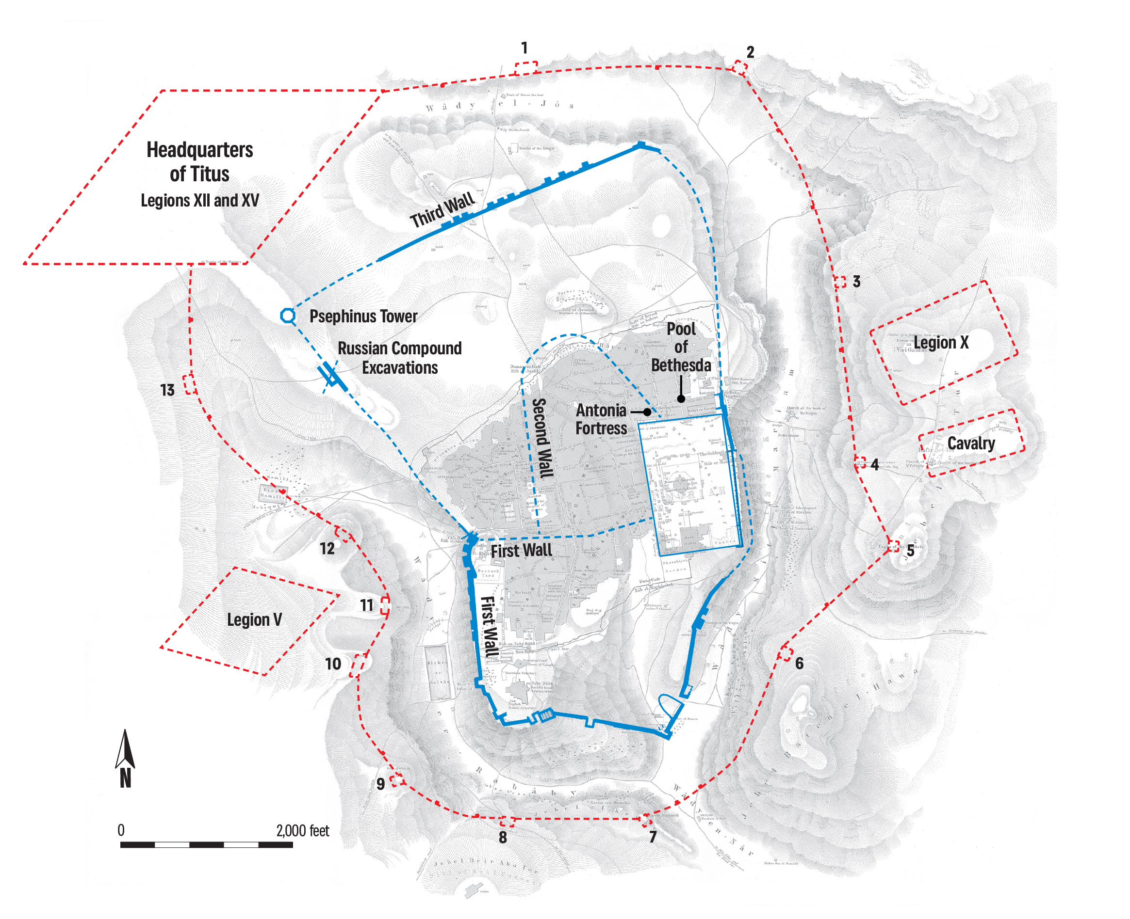
ADAPTED FROM THE 1850 GEOGRAPHICAL MAP OF VAN DE VELDE AND THE RECONSTRUCTION SURVEY DRAWING OF GYŐZŐ VÖRÖS
MAPPING JERUSALEM. The discovery of the last section of Jerusalem’s Third Wall made it possible to reconstruct the entire route of the city’s ancient fortifications (in blue). Since Josephus records that the Roman lines were two furlongs (about 1,200 feet) distant from the city wall, the line of the Roman siegeworks (in red) can similarly be reconstructed based on the city’s historical topography and geo-morphology. The siegeworks, which included 13 strategically positioned garrison camps along with Titus’s headquarters, extended around the city for a distance of 4.5 miles, matching precisely the measurement of 39 furlongs given by Josephus. The camps of the supporting Fifth and Tenth Roman Legions were pitched to the city’s west and east, respectively.