
Image Details
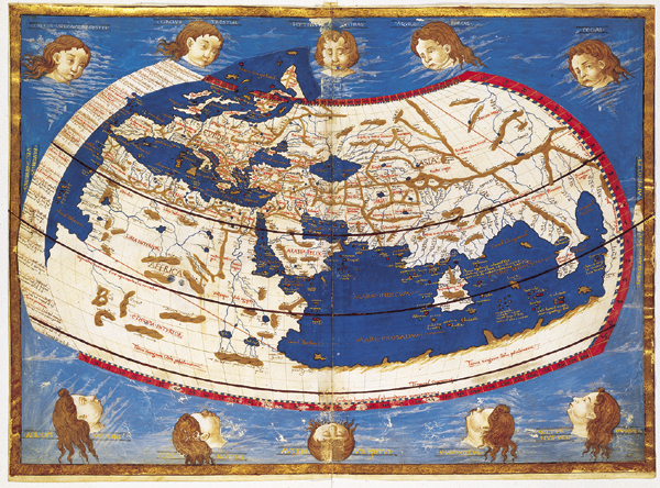
Biblioteca Apostolica Vaticana (MS. Vat. Lat. 3811, fol. IV-3R)
This map, 16.5 by 23 inches, now in the Biblioteca Apostolica Vaticana, was drawn in 1474 by Donnus Nicholaus Germanus, a German Benedictine monk working in Florence. Nicholaus worked from coordinates in Ptolemy’s Geography, but he also added information (about Scandanavia, for instance) not available in Ptolemy’s day.