
Image Details
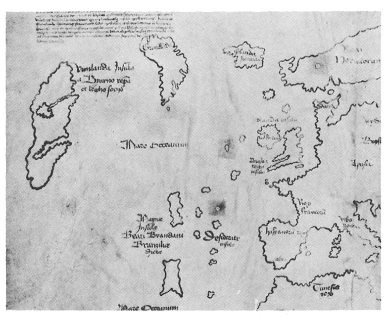
Section of the famous Vinland Map: Purchased by Yale University Library and first exhibited on Columbus Day, October 12, 1965, the Vinland Map shows three islands—Vinland, Greenland, and Iceland (right to left) Because Greenland was not known to be an island until the 19th century, and because it was discovered in 1974 that the ink used on the map dated from the early 20th century, the map is now considered to be one of the great modern archaeological hoaxes.