
Image Details
Survey of Israel and Israel Exploration Society
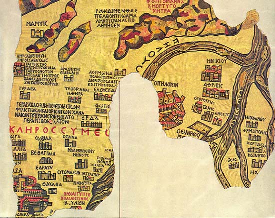
The Madaba map—famous mid-sixth century mosaic floor from a Byzantine church—is the earliest representation of the Holy Land. The details shown here are on the far right of the partially destroyed map. The rectangular area on the left includes a city (outlined in black) called Orda, whose name appears in Greek above a crenellated wall. Orda is the likely identity of the site of the mosaic floor recently uncovered at kibbutz Kissufim near Gaza. Gaza may be seen on the far left edge, but only the last two letters, ZA, were not destroyed. The area depicted on the right is the Nile Delta with the river clearly identified by the fish swimming in its streams. Above the horizontal upper branch of the Nile is a region identified in Greek as the “Desert of Zin where manna and quails were sent.” The destroyed area at the bottom once depicted the Mediterranean Sea.