
Image Details
Robert Wright
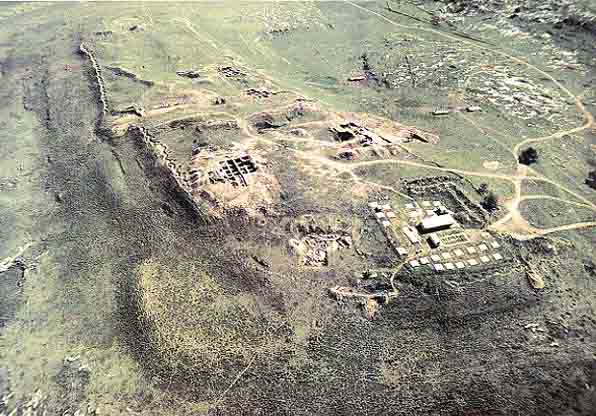
Aerial view of Gezer from the west. Ancient walls, modern roads, the crisscross of excavation grids, and neat rows of concrete tent platforms follow the contours of this huge 30 acre mound. The excavation camp, bottom right, housed a group of 130 professionals and volunteers who worked nearly a decade to expose many of the sites visible in this photo.
Appearing as a wavy vertical line in the upper left of the photo is an excavated segment of the outer wall, which some scholars date to the early 15th century B.C. About midway along the length of the mound, this wall appears to stop. Just to the right of this stopping point is the High Place, a row of monoliths erected for some uncertain purpose in the mid 17th century B.C. Below the High Place and parallel to the outer wall are remains of the inner wall, built in the same period as the High Place. See plan for identification of other features visible in the photo.