
Image Details
Arlene Rosen
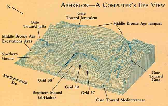
Flying the friendly skies over Ashkelon, thanks to modern technology. This topographic map, generated by a computer program that renders elevation measurements into graphic form, shows the important features of the city as they would have appeared from a hypothetical point above the Mediterranean. The small squares are a function of the program and do not relate to excavation squares. Though Ashkelon did drop precipitously to the sea along its western edge, the sudden drop here along the northern and southern sides is a result of the computer’s truncation of the view.