
Image Details
Garo Nalbandian
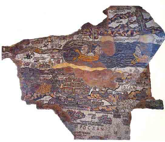
The Madaba Map. Boats glide along the Dead Sea (above the brown patch at center) in the oldest known map of the Holy Land, which decorates the floor of a sixth-century C.E. church in Madaba, Jordan. Propelled by oar, each boat carries two passengers whose images have been defaced, presumably by Byzantine iconoclasts who believed it was idolatrous to portray living figures in church art.
The boats travel on a north-south course along the Dead Sea, between Jerusalem (the oval area directly below the boat at left) and the salt swamps at the southern end of the sea, unseen here at right. The Jordan River, flowing from the north (at left), empties into the Dead Sea. The ancient mosaic artist here provides clear evidence that the Dead Sea was a busy shipping route in antiquity. More than two million colored tesserae, or tiles, lend the map its extraordinary detail.