Image Details

Eosat/Boston University Center for Remote Sensing
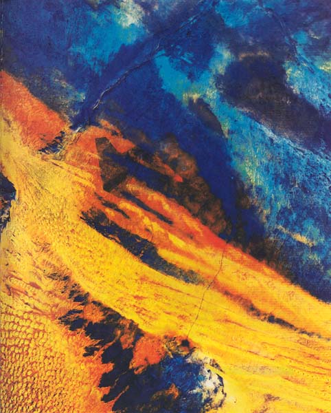
The desert sands of Saudi Arabia appear in brilliant yellow-orange in this satellite photo of a 10,000-square-mile region northwest of Riyadh. Only 4 inches of rain fall annually in Saudi Arabia today, and scholars have assumed that the region was equally arid in ancient times. But the jagged seam cutting through the blue (indicating limestone) at top center suggests otherwise: The seam is part of a river channel, concealed by the sand dunes in the bottom half of the photo, that crossed the Arabian peninsula from about 10,000 B.C.E. until 3500–2000 B.C.E., when it dried up. Dubbed the Kuwait River, the river channel—along with evidence of floods in Mesopotamia, deep lakes in Africa, grasslands and lakes in Arabia, and heavy forest cover along the eastern Mediterranean coast—provides testimony to a lengthy wet period in the ancient Near East.
Although author James Sauer has long doubted that archaeology could uncover evidence of the earliest Biblical stories, he now suggests that the Flood story of Genesis 7:6–8:14 may preserve remembrances of this wet period. The Kuwait River, Sauer argues, may even be the model for the River Pishon, associated with the Garden of Eden (Genesis 2:12).
