
Image Details
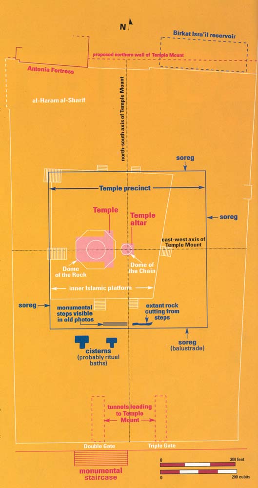
According to anicent descriptions of Herod’s Temple, the sacred inner precinct (with the altar at its center) was between 400 and 500 cubits square, which would align it roughly with the northern and western edges of the inner Islamic platform. The sourthern and eastern edges of the square soreg, however, would have extended beyond the current limits of the inner Islamic platform.
Having established the southern and eastern boundaries of the soreg, author Jacobson began scouring old photos and plans of the Temple Mount for archaeological remains of these boundaries. As discussed in the sidebar, he found evidence of a monumental stairway and some rock cutting, just inside the southern line of the soreg, that may date to Herod’s time. Further support for his southern line of the soreg comes from two rock-cut cisterns, mared on 19th-century plans, which appear to have been constructed as ritual baths (mikva’ot) in which Jewish worshipers would have washed before crossing through the soreg into the holiest areas of the Temple Mount.