Image Details

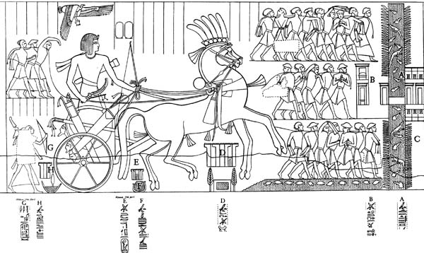
NO EASY WAY OUT. The “Way of Horus,” or the Coastal Road, from Egypt to Canaan was lined with forts about a day’s march from one another, as depicted in a relief of Seti I (1294–1279 B.C.) from Karnak. Seti is shown here returning from a campaign against the Shasu-bedouin, with POWs marching before the pharaoh’s chariot. Behind the pharaoh, labeled “G” in this drawing, is the fourth fort or “Edjo of Seti-Merneptal.” Directly beneath the horse’s tail is “E” or “the Migdol of Men-maat-re,” the third fort.
A crocodile-infested canal (“A”, “the dividing waters”) extends vertically on the right of the POWs and is surrounded by reeds. A bridge over the canal connects the two sides of the Tjaru fortress (“B”), which has been identified as Tell Hebua near Qantara East in Sinai and where a massive fortress from the 18th Dynasty (1540–1307 B.C.) has been found. The fort labeled “D” on the drawing (left of the horse’s front hooves) is “The Dwelling of the Lion,” which author James Hoffmeier believes is the site he has been excavating at Tel el-Borg. Not surprisingly, the Israelites avoided this road on their flight out of Egypt.
