
Image Details
The National Library of Israel
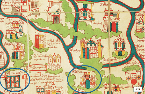
Medieval holy land maps locate Cana of Galilee north and sometimes west of Sepphoris. Fifteenth-century English priest William Wey created this map showing Cana of Galilee, depicted with six water jugs, north of Sepphoris.