
Image Details
Palestine Exploration Fund
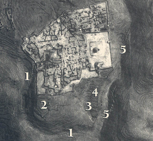
Three valleys define and protect three sides of Jerusalem, as seen in this photo (compare with next photo) of a 19th-century, topographic model. The walled Old City lies at center; in its lower right (southeast) corner is the almost rectangular Temple Mount platform, surmounted by the Dome of the Rock. Starting on the left side of the Old City, and hooking across the lower center like a giant “L,” the Hinnom Valley (1) bounds Jerusalem on the west and south. Within the Curve of the “L” and outside the Old City wall stands the western ridge, known today as Mt. Zion (2). To the right of Mt. Zion lies the short Tyropoeon, or Central, Valley (3). Extending down from the Temple Mount like a narrow finger, on a line with the Dome of the Rock, the eastern ridge, the City of David (4), separates the Tyropoeon Valley from the deep Kidron Valley (5), bounding the eastern side of the city. The eastern ridge was the site of Jebusite Jerusalem and the Jerusalem of King David.