
Image Details
Garo Nalbandian
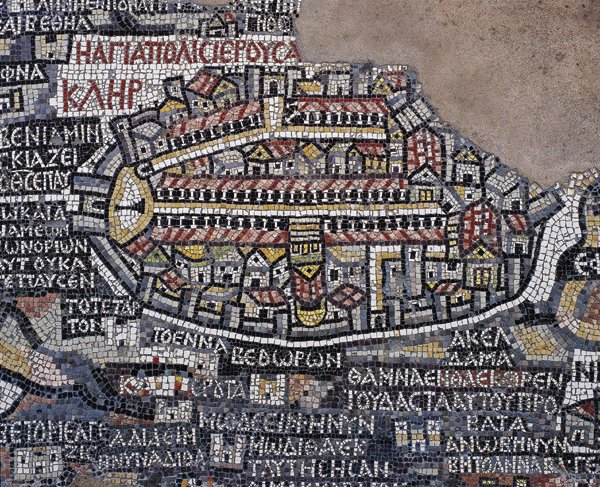
The Madaba map. A cluster of buildings, surrounded by an oval-shaped wall, represents Jerusalem in this sixth-century A.D. mosaic floor from a church in Madaba, Jordan. Lined by columns, the city’s main street, the Cardo Maximus, appears as a white line, extending from the Damascus Gate in the north (left) to the Byzantine Nea Church in the south (right). The Church of the Holy Sepulchre, depicted upside down, lies at the center of the Cardo, on the western (lower) side. Built by Constantine, the Holy Sepulchre included a 70-foot tall rotunda, erected over the isolated outermost chamber of the catacomb, which was considered to be the tomb of Jesus (compare with Church of the Holy Sepulchre plan). A colonnaded garden connected the rotunda with a large basilical church that opened onto the Cardo Maximus.
As pictured on the mosaic map, several steps led from the Cardo to the three entrances of the basilica, which has a triangular pediment and red roof (as do all churches on the Madaba map); the golden dome of the rotunda looms behind the basilica.