027
028
We were driving south, along the Gulf of Suez, heading for our excavation site when our jeep broke down. Fortunately, it happened on a paved road, before we turned onto the desert track that would take us to a desolate site in the interior of the Sinai Peninsula, still 65 miles away. We had another bit of good luck—a Bedouin mechanic from a nearby village offered to help. A friendly fellow, he happily engaged us in conversation.
“I’ve heard about you,” he said.
“Oh?”
“Yes. You’re the Israelis who are digging for gold in the hills near Jebela Musa.”
“No, no,” I said, but before I could go on, he interrupted.
“Yes, yes,” he smiled, “I know you’ve already found lots of it. The story has gotten around.”
We tried to explain but to no avail. Our transparently false “cover story” as to what we were “really” digging for simply convinced him of our unbelievability. How could we expect him to believe that we would take so much time and go to all this trouble and expense in order to find a few chips of flint, some broken pieces of pottery and a few courses of an ancient wall?
We drove off in our sturdily repaired jeep, leaving our Bedouin mechanic convinced that the rumors he had heard about our search for gold were true.
Naturally, we were not prospecting for gold, nor did we find any. But during our 15 years of excavation in Sinai, we have found simple, unimpressive structures and artifacts that to us are worth far more than gold. These scientific treasures reveal a score of vanished civilizations that once made Sinai their home.
On most popular maps, the Sinai Peninsula is almost blank—as if there was nothing there. If you look closely, you might find a settlement or two on the Mediterranean coast and a mark to indicate the location of the traditional site of Mt. Sinai in the southern part, but little else. The truth now, as it was in ancient times, is far different.
Between 1967 and 1982, when Sinai was under Israeli control, Israeli archaeologists literally put the peninsula on the map. Before that it was a kind of tabula rasa; we wrote on a clean slate—or practically so.
True, there had been the early travelers and explorers whose often accurate accounts stirred centuries of readers—from Egeria in the fourth century to the German scholar Carl Richard Lepsius in the middle of the 19th century. Some archaeological work had also been conducted here. For example, in 1905 Sir William Flinders Petrie explored the Egyptian temple with its hieroglyphic inscriptions at Serabit el-Khadem in south central Sinai, and he also recorded other inscriptions in the earliest known alphabetic script found in the nearby turquoise mines. Later expeditions continued to study this temple and its inscriptions. In northern Sinai, the French archaeologist lean Clédat excavated from 1910 to 1924 at Tel Farama (ancient Pelusium) on a branch of the Nile. Also in northern Sinai, Petrie dug near Sheikh Zuwaid, classical Anthedon. Israeli archaeologists had access to Sinai for a short time in 1956, and they too rushed in to do as much as possible in those few months.
But all these expeditions in the aggregate barely scratched the surface—if you will forgive the pun—certainly in comparison with Israeli activity during the 15 years Sinai was administered by Israel.
031
Between 1967 and 1982, dozens of Israeli expeditions mapped, explored and sometimes excavated hundreds of ancient settlements and cemeteries scattered throughout this vast region. Sinai’s hot, dry climate, its inaccessible mountain terrain, and its isolation from civilization made it a working laboratory for Israeli scholars of various disciplines—zoologists, botanists, geologists and, above all, archaeologists.
Israeli archaeologists were in a sense pioneers, surveying and excavating the unknown and reexamining the known or partially known. Much of the latter had been covered with sand, and in some cases even the location of the sites had been forgotten.
After 15 years of work in the field and preliminary analysis of our findings, we now have a far clearer picture of human activity in Sinai, going back to the dawn of civilization. We are also beginning to understand how the peninsula related to the two lands it borders—the Land of Egypt on the east and the Land of Israel on the north.
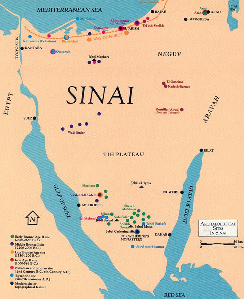
Much of the material on which my brief sketch here is based is still unpublished. The remainder of the material is available primarily only in technical preliminary reports and brief notes in Hebrew scientific journals. I have been personally involved in uncovering many of the finds, but a great part of the discoveries reported here were made by my colleagues, who have kindly made available to me the results of their work.
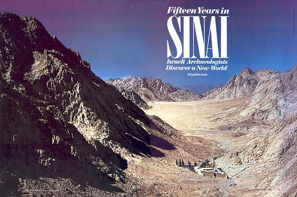
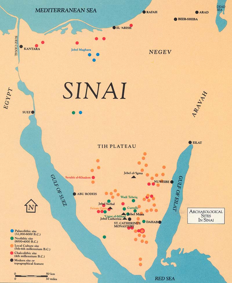
To most people, Sinai is known as the Biblical wilderness where the Children of Israel wandered for 40 years before reaching the Promised Land. It is indeed a vast peninsula, covering over 40,000 square miles. It is bounded on the north by the Mediterranean and narrows as one proceeds south to form a triangle with its apex at the Red Sea. Two fingers of the Red Sea border it on either side—the Gulf of Suez on the west and the Gulf of Eilat or Gulf of Aqaba on the east.
The popular view of Sinai is that it is one vast homogeneous wilderness. But nothing could be further from the truth. Its geological structure as well as its climate varies greatly.
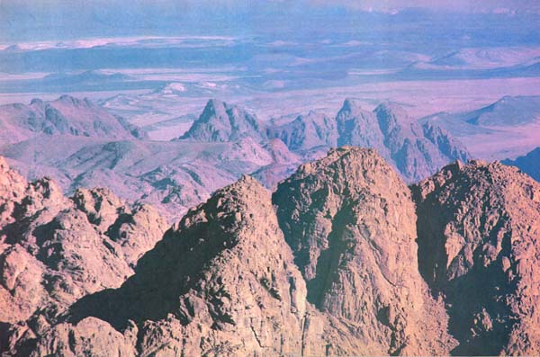
In the southern point of the Sinai triangle there rises a massif of rugged granite mountains composed of magnificently colored tiers of red, gray and black metamorphic and igneous rock cut by deep gorges that serve as the main routes across the peninsula. Here are the highest peaks of the peninsula—Jebel Musa, 9,000 feet above sea level, and Jebel Serbal, 6,900 feet above sea level, another leading contender among the dozen or more peaks that vie for identification as the site where Moses received the Tablets of the Law. This mountainous region in southern Sinai is comparatively rich in perennial springs and now supports a population of about 15,000 Bedouin.
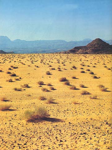
The barren Tih Plateau stretches across the middle part of the peninsula. In Bedouin folklore, this area is associated with the wanderings of foreign tribes in the remote past—hence its name, the desert of the Tih, which means wanderings. Proceeding from north to south on the plateau, limestone hills begin to rise above the broad tableland in the north. As one proceeds south on the plateau, the hills become almost imperceptibly higher until they culminate in Jebel et-Tih and Jebel el-‘Igma at the southern end of the plateau. The plateau ends abruptly in steep sandstone crags. The Tih is practically devoid of water and vegetation. Accustomed as we were to finding remains of human occupation in harsh, inhospitable areas, it still came as a surprise to discover numerous flint implements from various periods lying amongst the black-and-white gravel (hammada) of the Tih Plateau.
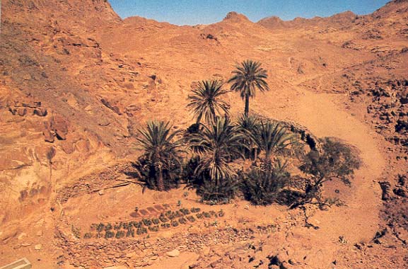
Between the lofty granite mountains in the south and the chalky cliffs at the southern end of the Tih Plateau is a narrow strip of Nubian sandstone that contains the richest mineral resources in the peninsula. Here, in ancient times, turquoise and manganese were mined. The population in this area clustered around a number of verdant oases like Abu Rodeis and Bir Nasb, which are dotted with date palm groves, orchards and small gardens. The present Bedouin population of this area is about 10,000.
In the northwestern hill region of the peninsula, a number of small peaks rise from 2,300 to 3,500 feet above sea level. Very little water falls here, supporting a correspondingly sparse population.
The other areas of the peninsula are the coastal strips—covered with sandstone, marl and shifting sand dunes. These border the Gulf of Suez on the west, the Gulf of Eilat on the east and the Mediterranean Sea on the north. The underground water level is high enough to be reached by wells bored from the surface, so these areas are capable of sustaining a comparatively large number of people, concentrated in fishing villages and small centers that supply services to the population. The coastal strip in the north covers considerably more territory than those on the east and west and consequently is more heavily populated.
The Sinai peninsula belongs to the same climatic zone as the deserts of Libya, Egypt and Arabia (Saharo-Arabian 032zone). Annual precipitation in Sinai rarely exceeds 60 millimeters, except along the Mediterranean littoral. During some years, the rain does not come at all. Such a harsh climate tolerates little vegetation except in oases and wadib beds. In the wadis, low shrubs and thorny trees like the acacia sustain themselves on the rare floodwaters that burst upon the peninsula during the winter.
The Bedouin inhabitants of Sinai aggregate about 80,000. Most of them are concentrated around El ‘Arish, the informal “capital” of the peninsula, located on the northern coast. The rest of the Bedouin are scattered in tribes living along the coasts, in the main wadis and in and around oases.
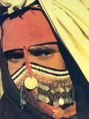
Despite the harsh living conditions, which have prevailed for millennia, Sinai has always been inhabited.
Abundant archaeological remains testify to the presence of people in Sinai throughout the ages. Each period of settlement has its special characteristics.
It is remarkable that one of the best-understood periods in Sinai is also the most ancient. Professor Ofer Bar-Yosef of the Hebrew University of Jerusalem led an expedition that investigated both the northern and southern parts of Sinai, from which most of our material regarding prehistory comes. His expeditions found evidence of a nomadic society in Sinai as early as the Late Paleolithic period (32,000–28,000 B.C.). We don’t even have a name for the people who inhabited the Sinai peninsula at that time, but they lived in northern Sinai in the barren (at least today) hills around Jebel Maghara and Jebel el-Lagama, not far from such rich water sources as Bir Gafgafa. They continued to inhabit this area into the Epipaleolithic period, which lasted until about 8000 B.C. Bar-Yosef discovered many of these nomads’ old campsites, where they left their surprisingly sophisticated flint implements. Most were scrapers and knives. But archaeologists also found tiny rectangular or trapezoidal flint blades known as “microliths,” which could have been mounted end-to-end in a wooden haft—long since decayed, of course. The result would have been a large cutting tool like a sickle.
033
This flint (or lithic,c as the scholars call it) industry was already well-known to us from sites in the Negev highlands of southern Israel. The flint styles are the same, so we may assume that they were made by people of the same culture. Probably the Negev group gradually expanded south into northern Sinai. From their tools and the remains of their settlements, we can deduce that they were nomadic groups of hunters and food gatherers who encamped in small groups of not more than a hundred or so people.
These nomadic people seem to have come to northern Sinai from the Negev; other groups came to Sinai from North Africa. The earliest evidence for expansion from the area that was to become Egypt is from the period known as “Neolithic Pre-Ceramic B” (8000–5500 B.C.). The hunters from this period are well-known from their characteristic flint tools, previously found in the Nile Valley and Morocco. As we have seen, the Late Paleolithic people who came from the Negev in the north settled in northern Sinai. The neolithic newcomers who came from what was later to become Egypt settled in southern Sinai.
Even some of the stone dwellings of these Neolithic people have survived. A typical settlement lies in the Wadi Tebeiq, near the new road from the Gulf of Eilat to about 40 km north of Santa Catherina. The settlement 034covers about 750 square feet and consists of more than 20 interconnected circular structures built of unworked stone blocks. Some of these building blocks are quite large, in several cases over ten feet around. The excavators concluded from the amount of stone rubble in the debris that the stone portions of the walls were fairly low. The upper parts of the walls and the roofs must have been constructed of lighter materials, such as mudbrick and mud plastered branches. The dwellings had doorsills of flat stone slabs and fire pits with hearths. Grinding stones, stone bowls, Red Sea shells, a few goat bones and a large variety of flints, including arrowheads, awls, drills, scrapers and various types of blades were found in the houses. At ‘Ugrat el-Mihad, a few kilometers north of Jebel Catherina, the excavators found the same lithic assemblage, but they did not find the same kind of dwellings. Instead they uncovered six large oval-shaped structures 035that they assume were not roofed, since the remains of their walls were very low and there was not enough stone rubble around them to imagine that they ever stood much higher. The floors were paved. Perhaps these structures were sunken storage silos.
The fourth millennium B.C. is known to archaeologists as the Chalcolithic period. Etymologically, the name refers to the copper widely used by these people who lived more than 5,000 years ago. In Sinai, however, it was not copper that these people were mining but the rich veins of turquoise in the southwestern sector of the peninsula; these Chalcolithic people, as we shall see, were the first to exploit the turquoise mines.
In Israel, the Chalcolithic period is often referred to as the Ghassulian culture, after the site of Ghassul in the Jordan Valley where this culture was first identified. The “Ghassulians” from the Chalcolithic period have now been identified at numerous sites in northern Sinai. A survey conducted by the Ben-Gurion University of the Negev and directed by Professor Eliezer Oren found over 700 ancient sites from all periods strung along the main routes between Egypt and Canaan in the area between Rafah and the Suez Canal in northern Sinai. Over 100 of these sites included remains from the Ghassulian culture of the fourth millennium B.C.
At none of these sites, however, were any architectural remains uncovered. The pottery sherds that dated the sites and the occupational levels were typical of temporary encampments, and the archaeologists think they may have been wayside stations on the main route between Canaan and Egypt. Many of the sherds came from pots and jars that we recognize as having originated in either Egypt or Canaan.
As we already mentioned, Ghassulian culture in Sinai was confined almost exclusively to the northern coast. Intensive surveys elsewhere in Sinai failed to uncover other Chalcolithic sites—with one interesting exception.
At the foot of the mountain on which Serabit el-Khadem is located in south-central Sinai, we discovered a small Ghassulian settlement. I directed the excavation of this site, which turned out to be a work camp for miners employed in the famous turquoise mines of Serabit. It thus appears that these Chalcolithic people were the first to identify and exploit this mineral wealth that was later to assume such importance to the Egyptians.
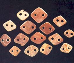
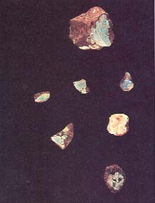
In the ancient world, turquoise was highly prized. The rich deposits of semiprecious stone lying in the wadi embankments in this area are the only source of turquoise in the entire eastern Mediterranean. In and around this small Chalcolithic site, we found unpolished gems, hematite hammers to quarry the turquoise-bearing blocks of sandstone, flint blades to extract the turquoise nodules, grinding stones to polish the gems, and large quantities of Ghassulian pottery.
We know from pottery sherds originating in Canaan that the Sinai “Ghassulians” had extensive contact with the north, but very few turquoise artifacts have turned up in Chalcolithic levels of excavations anywhere in Canaan. By contrast, at Egyptian sites, and particularly in tombs, considerable turquoise has been found. So we assume that most of the turquoise mined in Sinai at this time was exported to Egypt. Yet there is no evidence whatever—not even a few Egyptian sherds like those found in Chalcolithic sites in northern Sinai—that the Egyptians themselves were involved in these mining operations. As we shall see, 700 years later during the Third Dynasty (around 2600 B.C.), the Egyptians actually operated the mines and left temples to Hathor, mistress of the turquoise, to prove it. But in the Chalcolithic period the Egyptians were not involved. The Chalcolithic miners from Canaan were apparently independent entrepreneurs who sold their product on the Egyptian market.
Another phenomenon that belongs to the same chronological period—but not to the same culture—is the nawamis. These are beehive-shaped structures built of sandstone slabs or metamorphic cobbles. Found only in southern and eastern Sinai, they appear to have been built in clusters, each cluster lying several kilometers from its nearest neighbor. The nawamis are between 10 and 20 feet in diameter and approximately 7 feet high. Their walls curve inward towards the top to form a corbeled roof supported by a large stone slab. It is amazing that many of these roofs are still intact after thousands of years! Nawamis means mosquitoes in Arabic. The Bedouin call these curious structures nawamis because, according to local legend, they were built by the Israelites during their sojourn in the wilderness to protect themselves against mosquito attacks.
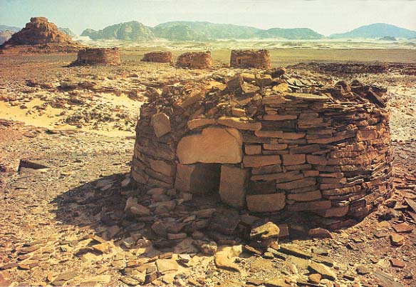
In fact, the nawamis are burial structures. Early Sinai explorers examined them and even excavated a few. The first comprehensive study of these tombs occurred in the early 1970s, when an expedition led by Ofer Bar-Yosef of the Hebrew University and Avner Goren, Archaeological Staff Officer for Sinai at the time, excavated a field of 24 nawamis in the Haggag Valley about 20 miles inland from Nuweibe on the Gulf of Eilat. Later, Goren excavated nawamis in eight other fields.
Each namus (singular of nawamis in one Bedouin dialect) contains several burials. Presumably these are members of the same family or clan. Sometimes the burials are what scholars call primary, and sometimes secondary. A primary burial is an interment immediately after death. A secondary burial is an interment of bones only, reburied after the flesh has decayed. The bones from these nawamis 036are now being studied by a team from the Tel Aviv University School of Medicine. Many characteristics of the bones conform to the Gracile Mediterranean type found in Israel. These similarities may give some hint of the origin of the nawamis population, about whom we know so little. The funeral offerings in the nawamis included shell bracelets, faience beads, flint tools, and juglets, as well as tools made of bone and copper—all reflecting contacts with both Canaan and Egypt.
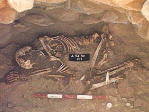
When I first began writing this article for BAR, I included the nawamis phenomenon in my discussion of the Early Bronze Age rather than the Chalcolithic period, because the best scholarly guess then was that the nawamis were built in Early Bronze Age I, or EB I (3150 B.C. to 2850 B.C.). Very recently, however, in one of the nawamis burials, we found two juglets from what is known as the Naqada Id period in Egypt. Since this period parallels our Chalcolithic period, we now have some solid basis on which to date these tombs to the Late Chalcolithic period, or from about 3400 B.C. to 3150 B.C.
Each namus has a short entrance corridor, constructed of upright stone slabs, which invariably faces the setting sun. Some scholars suggest, because of the westward orientation of the tomb entrances, that these people shared the Egyptian belief that the soul journeys to the west after death; this strengthens the possibility of an Egyptian origin for them.
Whoever these people were, there is no doubt that they had a highly developed culture and were capable of constructing the architecturally sophisticated nawamis with corbeled roofs. Nawamis could not have been the work of nomadic desert tribes. Whether or not the builders of the nawamis came from Egypt or from the Asian continent, however, is still unknown.
Elsewhere in Sinai, especially in the eastern and southern sectors, there may be other fourth-millennium sites, representing a local culture, among the hundreds of poor, small settlements discovered by Israeli expeditions. But these settlements cannot be dated securely. The kinds of flint tools found—there is no pottery—cannot be used as chronological indicators because the same forms were used for hundreds and even thousands of years. Several scholars believe that some of these flint tools should be dated to the fourth millennium, but as yet there is no scholarly consensus.
The Early Bronze Age (3150 B.C. to 2200 B.C.) witnessed a population explosion all over the Near East. This occurred in Sinai as well, particularly in the southern part of the peninsula and in the northern coastal strip.
The Early Bronze Age is subdivided into three periods, 039each with its own characteristics. Early Bronze Age I (3150 B.C.–2850 B.C.), or simply EB I, which corresponds to the proto-Dynastic period in Egypt, is represented by small unfortified settlements along the northern coast of Sinai. Here, an expedition sponsored by Ben Gurion University of the Negev collected both Canaanite and Egyptian pottery. As in the preceding Chalcolithic period, these small settlements undoubtedly marked the route between Egypt and Canaan. Traders were apparently already exploiting the economic resources (olive oil and wine) of southern Canaan, as they would so extensively in the following period (EB II). No other EB I sites have been found in Sinai except a large village in Wadi el-Fugiya in central Sinai, 30 miles east of Ras es-Sudar, discovered by Beno Rothenberg’s expedition.1
One of the most surprising discoveries of my expedition (the Ophir Expedition) in southern Sinai was a whole series of settlements from the Early Bronze Age II (2850 B.C.–2650 B.C.). Six were excavated, but more than 40 additional sites were identified by surveys, all in the massive granite mountains in the heart of the peninsula.
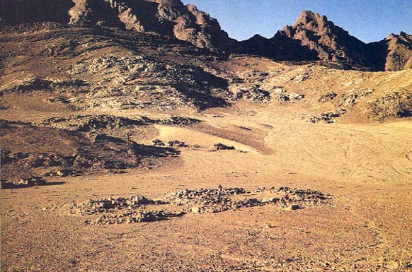
Each of these small settlements consisted of from one to five dwelling units about 100 feet apart. Each dwelling unit was made up of from 10 to 20 interconnected rooms surrounding a large central courtyard. Some smaller dwelling units had only one or two rooms linked to a stone fence around the courtyard. Apparently one of the rooms was actually the dwelling and the other was an auxiliary chamber, perhaps for storage or sleeping. The floors of these auxiliary chambers, although usually paved, are slightly higher than ground level. Because most of the walls are low enough for a person to step over—as we deduced from the small amount of stone rubble around them compared to the quantity of rubble on both sides of the collapsed walls of the dwellings—we concluded that they must have been workrooms or storage rooms, perhaps protected from the sun by a tent-like covering of hides.
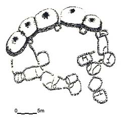
Each of these units was probably occupied by a single large or small family, according to the unit’s size. The main room was of the “broadroom” type—wider than long, with the entrance through one of the long walls. In effect each unit was, in architectural terms, a “one-room house.” All the entrances face the central courtyard of the settlement. The floors of the main rooms are about a foot and a half lower than the courtyard floor. You descend one to five steps from the courtyard to the house.
Each roof was supported by a pillar in the center of the room opposite the entrance. The pillar was either a monolith or a stack of several stone drums. Stone benches lined the walls, and in the corners of the rooms were cooking hearths or small storage bins.
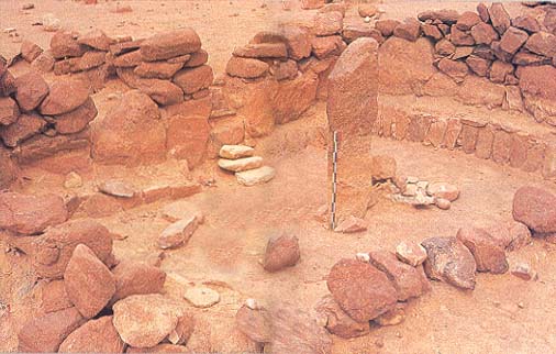
The architecture of these dwelling units is important 040because it helps us identify these peoples’ place of origin. Exactly the same type of one-room house was built in Canaan in the Early Bronze II period. Such Canaanite houses are especially abundant at Arad, then a large fortified royal city in the Negev; indeed, Arad was the largest city in southern Canaan.
The similarity between the pottery found in these EB II sites in Sinai and at Arad confirms the relationship. In the Sinai sites some of this pottery appears to have been made locally, but a great deal was imported from Canaan. Whether made locally or imported, the same kinds of vessels turned up at our Sinai sites as in Strata III to I (the Early Bronze Age strata) at Canaanite Arad—pithoi (large storage jars), platters, red-slipped bowls and little loop-handled cup-bowls.
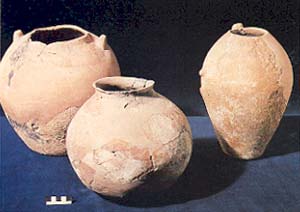
The rare fragments of First Dynasty Egyptian vessels we found in the Sinai sites only emphasized that the Canaanite relationship, especially with Arad, was the overwhelmingly important one.
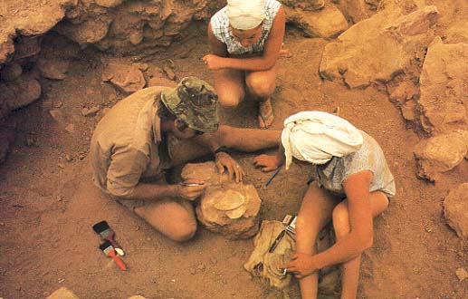
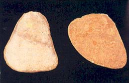
In addition, we found flint tools (mostly scrapers and perforators), pendants and beads made of a local greenish stone, and over 80 different species of Red Sea shells. Of special importance were a number of copper tools, mainly axes and awls, produced from local ores.
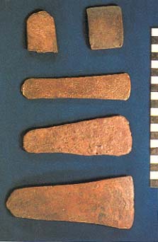
It appears that these EB II people in Sinai were Canaanites from the southern part of the country, perhaps from Arad itself. They built themselves settlements modeled after the houses they had known in Canaan and continued to maintain close contacts with their homeland to the north.
The diet of the EB II people consisted of milk, cheese and meat produced by their flocks of goats or sheep. Based on the relative quantities of bones found in the excavations, the goats far exceeded the sheep. In addition, these Sinai settlers apparently ate cereals, probably imported from Canaan. These pioneers adapted themselves very well to the desert environment and seem to have learned how to exploit its economic potential.
But the question remains: What prompted these people to leave the cities of southern Canaan and migrate over 400 miles to this remote wilderness? The biggest reason was probably copper. In every site we excavated, we found copper tools and copper ores. In two sites we found crucibles, lumps of refined copper and casting molds. In our 041survey we came across three sites with evidence of copper production—smelting ovens sunk into the ground with lumps of ore and slag strewn about, and pieces of clay piping that must have been part of a bellows. These sites lie very close to an ancient copper mine, and chemical analysis has shown that this mine was the source of the ores and slags we found. Copper—the major component of bronze—was extremely valuable in those days before people learned to create a fire hot enough to melt iron. (See “How Iron Technology Changed the Ancient World—And Gave the Philistines a Military Edge,” BAR 08:06, by James D. Muhly.) It is thus not difficult to understand Sinai’s attraction to these EB II settlers. They were probably “colonists” from royal Canaanite cities; the “mother city” of our Sinai settlements was very likely the powerful city-state of Arad. Since we found so little evidence of an Egyptian presence anywhere in Sinai at this time, we may assume that the Pharaohs had no interest in the region then. Only after another two or three centuries would Egypt’s economic interest in Sinai become aroused, as we shall see. In the meantime, Canaan had the peninsula and its valuable mineral resources all to herself.
Egyptian interest in Sinai began in about 2650 B.C. during the Third Dynasty. What attracted the Egyptians was not copper, but turquoise, that semiprecious blue-green stone from which artisans made amulets, scarabs, 046and necklaces for Pharaohs and nobles. We have no doubts about the Egyptian presence because the mining expeditions left evidence behind, and it is still there. Maghara means cave in Arabic; that is the name the Bedouin have given to this area in southwest Sinai because of what they took to be caves in the steep sides of the wadi embankments.e In fact, these “caves”, are Egyptian mine shafts from the Old Kingdom, formed when the ancient miners followed the blue-green veins of turquoise into the cliffs above the wadis here.
Remains of expedition camps, including a number of buildings, have come to light in some places along the scalps of the wadis. Of special interest are the many stone reliefs and inscriptions that provide a secure dating for the Egyptian mining activity. Sir Flinders Petrie hewed about 40 of these reliefs and inscriptions out of the cliffs in 1905 and sent them to the Cairo Museum. Much of this material had been found by early 19th-century explorers of Sinai. But a good deal of what these explorers had found was lost or forgotten by the 1910s. Israeli archaeologists and surveyors launched a comprehensive program of rediscovery.
One curious rediscovery was a relief of Pharaoh Sekhemkhet (the third king of the Third Dynasty, who 047reigned from 2648 B.C. to 2642 B.C.) carved on one of the high cliffs above Wadi Maghara; this relief was found near an almost identical relief that was well-known to scholars. Professor Raphael Giveon, an Egyptologist from Tel Aviv University who studied both reliefs, has plausibly suggested that the duplication was required by the inscribers’ errors. Omitted from the newly rediscovered relief, which must have been carved first, were some of the titles of the head of the mining expedition. Moreover, the carvers did not carve this important person’s image in high enough relief. Consequently, he ordered them to do the job a second time, and this time to include all his titles and to carve his handsome picture in high relief.
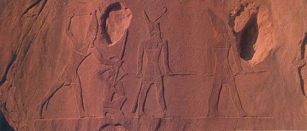
During the Middle Kingdom, in the 12th Dynasty (1991 B.C. to 1186 B.C.), the Egyptians moved their turquoise mining operation to the rich veins of Serabit el-Khadem, a famous site in west-central Sinai. They continued to operate these mines for at least eight centuries thereafter, during the New Kingdom and up to the reign of Rameses VI (1191–1134 B.C.). At Serabit, the Egyptians left some of the most magnificent ruins in all of Sinai. Near the mines, on a mountain plateau, the Egyptians built a temple dedicated to the goddess Hathor, who among her other epithets was known as the “Lady of the Turquoise.” Originally the shrine to Hathor was only a cave where the goddess was worshipped in the 12th Dynasty (1991 B.C.–1786 B.C.). Then a portico was built in front of the cave. Next, a magnificent temple was built in front of the portico. Countless mining expeditions thereafter rebuilt and added chamber after chamber—ablution halls, courtyards, pylons, and room after room in an extended string, entered from a sacred way that eventually reached 230 feet, lined with stelaef and statues. The walls of the temple and the stelae are covered with hundreds of hieroglyphic inscriptions. It is a breathtaking sight. The latest of the rooms and the last addition to the sacred way date to about 1140 B.C., thus providing an almost complete series of Egyptian inscriptions from the time of the 12th Dynasty to the 26th Dynasty.
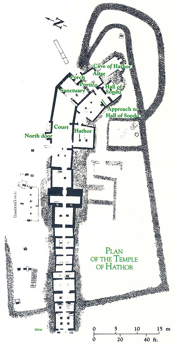
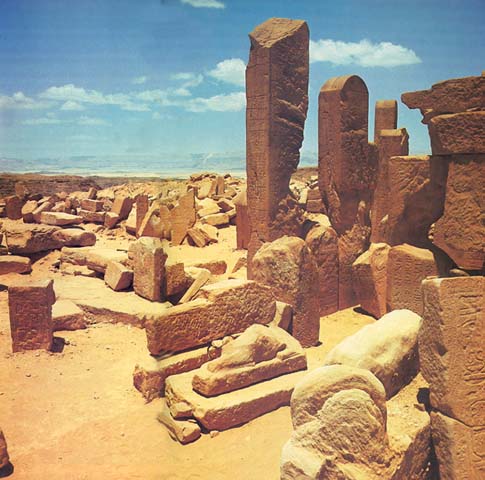
The ruins of Serabit were first discovered by Carsten Niebuhr, a member of an early Danish expedition, in 1162. Later they attracted the attention of numerous scholars, the most famous of whom was Sir Flinders Petrie, who explored the site in 1905. In 1935 the Czech scholar Jeroslav C
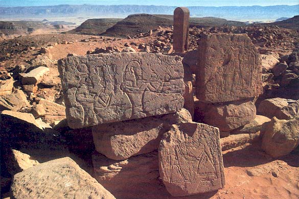
Professor Raphael Giveon, Egyptologist of the University of Tel Aviv, restudied the site and found numerous inscriptions that were either unknown or had been “lost” or forgotten. One was an inscription of Thutmoses IV (1425 B.C.–1417 B.C.) that had been “lost” since 1859; Giveon rediscovered it about half a mile southeast of the temple. The inscription in fact turned out to be much longer than the previous publication of it had indicated. It contained a kind of appendix consisting of a so-called private text of an overseer, which was dedicated to Princess Wadjoyet, one of the daughters of Thutmoses IV.
Giveon’s expedition also discovered three reliefs depicting Hathor in her Egyptian form as a sacred cow. Another such relief had been discovered by C
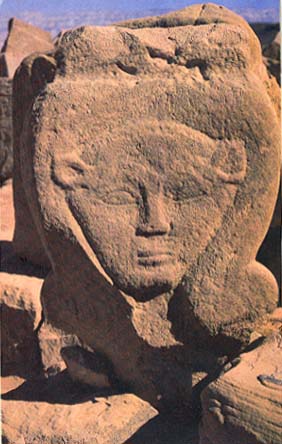
The scholars who contend that Hathor was also worshipped as a Canaanite deity at Serabit rely on some of the most fascinating archaeological materials ever discovered—the so-called proto-Sinaitic inscriptions.
E. H. Palmer discovered the first proto-Sinaitic inscription in 1869. Petrie found about ten more in 1905 in the temple area, and the rest were discovered on stone slabs near two of the mineshafts, apparently scratched there by the miners.
Unlike the hieroglyphic inscriptions, the proto-Sinaitic inscriptions are written in an alphabetic script probably invented under hieroglyphic influence. The script represents the earliest form of the Semitic alphabet—from which all other alphabets are derived.
Scholars still do not agree on what these inscriptions say, but in general they agree on the identity of most of the letters. However, the meaning of one word that appears repeatedly in the proto-Sinaitic inscriptions is universally undisputed. Not until ten years after Petrie’s discovery of the proto-Sinaitic inscriptions was this word deciphered—by Sir Alan Gardiner, one of the great Egyptian linguists of modern times. That single word is l-b-‘g-l-t or l-‘ba-al-at. It means: “to Baalat,” the female form of the Semitic god Baal.
This word suggests to many scholars that some of the miners themselves worshipped Ba‘alat in the form of the Egyptian deity Hathor. The miners’ use of a Semitic alphabet indicates that they were Semites rather than Egyptians. In a few Egyptian inscriptions at Serabit, Asiatics or ‘Amu are mentioned as participating in the Egyptian expeditions. One inscription refers to a certain Khebdedem, “the brother of the governor of Retjenu.” (Retjenu is the Egyptian term for Canaan.) These Egyptian inscriptions confirm the presence of Semites at the site. In our opinion, the proto-Sinaitic inscriptions were undoubtedly written by Asiatics working there as free men, perhaps even as specialists, such as coppersmiths and the like, attached to the Egyptian mining expedition. It is obvious that whatever their status, they were literate and used an acrophonich alphabet. This alphabet, although very closely related to Egyptian hieroglyphics, was nevertheless a departure from the complicated system that the Egyptians used in writing their own language. This alphabet may well have originated in Canaan itself.
In and around Serabit el-Khadem, the Ophir Expedition, which I directed, has made discoveries that are extremely useful in a number of respects, perhaps most important in dating the proto-Sinaitic inscriptions to the late 16th and early 15th centuries B.C.
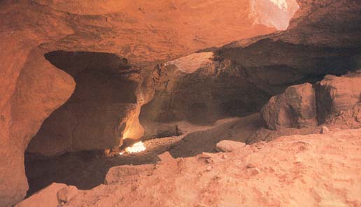
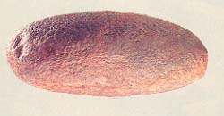
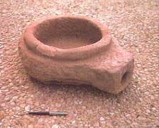
Inside one of the mines (Mine L, which is the most famous because it is there that the longest proto-Sinaitic inscription was found), my expedition discovered more than 40 casting molds for bronze mining axes and other tools. A number of ceramic crucibles, some with a thin film of copper residue still adhering to them, were also found inside the mine. A unique stone bowl with a large spout was at first a puzzle. What was it used for? We finally decided it was the base of the air chamber of a bellows, probably originally fitted with a leather bag and pumped by foot, like similar instruments depicted on Egyptian wall paintings. All this equipment—the molds for mining tools, the crucibles, the bellows—indicates that metal-smiths were included in the mining work force. Their function was to melt down broken tools and to recast new ones on the spot. In our metallurgical laboratories at Tel Aviv University we cast a few axes in gypsum from the ax molds. These axes and the bellows we found turned out to be similar to those common in Egypt at the beginning of the New Kingdom (16th–15th centuries B.C.), as depicted in dated wall reliefs in Egypt. Together this material is of great assistance in dating the mining operations.

Another important bit of dating evidence we discovered was a sherd of bichrome ware, a type of pottery produced only in this period.
In Mine L we also discovered a stone plaque bearing the letters alef and lamed in proto-Sinaitic script, which spell ‘El, the principal north Semitic deity at the time. ‘El is also a common name for God in the Hebrew Bible.
In a mine about a kilometer southeast of Mine L, Benjamin Sass and Judith Dekel discovered two previously unknown proto-Sinaitic graffiti,i thereby increasing the corpus of proto-Sinaitic inscriptions by about ten percent! Perhaps this will help us one day to decipher fully the proto-Sinaitic inscriptions.
Inside this mine we found a faience bowl from the beginning of the New Kingdom. Outside were some more crucibles and another foot-operated bellows, identical to what we had found in Mine L. All these artifacts establish that the Egyptians were most active at Serabit el-Khadem during the New Kingdom (1550 B.C.–1100 B.C.).
In my chronological catalogue of the remains at Serabit 049el-Khadem, I got a little ahead of myself. But I didn’t want to interrupt the exciting story of Serabit, even though the proto-Sinaitic inscriptions date to the Late Bronze Age (1550 B.C.–1200 B.C.). Let us go back for a moment now to some Sinai remains from the Middle Bronze Age I (2200 B.C.–2000 B.C.). BAR readers already know about the mysterious MB I people described by Rudolph Cohen in the July/August 1983 issue (see “The Mysterious MBI People,” BAR 09:04). Many MB I settlements were found in the Negev highlands in southern Canaan; traces of such settlements have also been found in northern Sinai. The houses consist of clusters of circular rooms separated by narrow open spaces or lanes, very unlike the EB II units of interlinked houses surrounding a large courtyard. Cohen suggests that the MB I settlers came out of Sinai and migrated into Caanan. My own view is the reverse. The MB I culture did not originate in Sinai but came from the opposite direction—from the north—and (with one exception) did not reach southern Sinai. Thus I believe the MB I settlements along Wadi Sudar represent the boundary of the southward migration of these nomadic Negev highlanders.
Moreover, I also disagree with Cohen in his effort to link these MB I people to the earlier Early Bronze II (EB II) people. Not only is their geographical dispersal in Sinai different, but they had entirely different architectural concepts: The MB I people had round, above-ground houses joined together like a cluster of grapes; the EB II people built sunken bench-lined broadrooms linked together in a 052circle or oval around a large, common courtyard.
According to the generally accepted scholarly chronology, the Israelite Exodus from Egypt occurred at the end of the Late Bronze Age, in about the 13th century B.C. For this reason, the Late Bronze Age (1550–1200 B.C.) in Sinai is of special interest.
Except for the turquoise mining and the associated temple at Serabit, the archaeological remains in Sinai from the Late Bronze Age are confined to the Mediterranean littoral in the extreme north. Then, as now, a major international “highway” followed the coastline and formed the main artery connecting Egypt with Canaan and the lands to the north. In Late Bronze Age Egyptian inscriptions this highway was called “the Way of Horus.” In recent years, literally hundreds of sites have been discovered on this highway in northern Sinai, mostly by the Ben-Gurion University of the Negev Expedition headed by Eliezer Oren. Among these sites were several Egyptian forts or depots to supply the caravan trade. These forts were concentrated along the stretch of road extending between the eastern Nile Delta and El ‘Arish. One of the larger forts was excavated at a site called Bir el-‘Abed (the well of the Servant [of God?]). Built of mudbrick, the fort measured about 125 feet square. Nearby was a large silo that still contained remnants of grains—a vivid illustration of the function of these forts in the Egyptian military system during the reign of Seti I (1318 B.C.–1304 B.C.).
Another stronghold in this network of forts was discovered somewhat further north, in the Gaza Strip near Deir el-Balah. Associated with this fort was an unusual cemetery in which the dead were buried in large clay coffins with strange faces molded on the coffin lids. A number of the coffins and the settlement where they were manufactured have been excavated by Hebrew University archaeologist Trude Dothan (see “Excavating Anthropoid Coffins in the Gaza Strip,” BAR 02:01, and “What We Know About the Philistines,” BAR 08:04, by Trude Dothan). Other Egyptian military posts along this highway are probably still buried under the sand dunes. Still others may no longer be preserved even underground.
But what of the rest of Sinai at the end of the Late Bronze Age? This is the time of the Exodus from Egypt, and according to the Bible, the Israelites dwelt in Sinai for 40 years, spending much of this time wandering in the wilderness. It was then, supposedly, that the tablets containing the Ten Commandments were given to the Israelites on one of Sinai’s mountains. But which mountain? And what about the route of the Exodus? For centuries Biblical scholars, pilgrims and archaeologists have been searching for traces of the Israelites throughout the peninsula, trying to identify the route the Israelites followed and the location of the Mountain of God.
Although there are dozens of theories, none is supported by archaeological evidence. And much as we had hoped otherwise, our recent explorations have not advanced us toward a solution. Nowhere in Sinai did we or our colleagues find any concrete remains of the stations on the Exodus route, nor even small encampments that could be attributed to the relevant period. Neither did we discover anything that would help us identify the Mountain of God. So the enigma—and the challenge—remain.
Some scholars attribute the lack of archaeological evidence of the Israelites in Sinai to the theory that their vessels were made of wood, leather, gourds or other perishable materials. Other scholars suggest that the stations on the Exodus route mentioned in the Bible, with the exception of one or two sites in the Nile Delta, have been either covered over and obliterated by the desert sands or washed away by erosion. On the basis of our thorough surveys, however, we find it difficult to accept these arguments. There are thousands of ancient sites in Sinai, many of them predating the Exodus. The people who lived at many of these sites used pottery vessels, and the broken pottery sherds survived and have been discovered on the spot. Indeed, frequently they are found lying exposed on the surface after thousands of years. The notion that the Israelites had only vessels of perishable materials during their 40 years of wandering is most unlikely. If the poor indigenous nomads of the peninsula produced pottery vessels throughout the ages, there is no reason to suppose that the Israelites fleeing from the Land of Goshen had no pottery. Indeed, the Israelites in Goshen, who complained so bitterly when Pharaoh’s overseers wouldn’t supply straw to temper the clay of the bricks they were forced to produce and demanded that they go out and gather it themselves while still fulfilling their production quotas (Exodus 5:6–19), undoubtedly knew quite a lot about the composition of clays for various types of ceramic wares. If they knew straw was needed to make bricks, then they must have known that grits were needed to make clay cooking pots.
And so the riddle continues unsolved. But as a result of the intensive surveys conducted in the high mountains of south-central Sinai (the traditional location of Mount Sinai), we must conclude that no new ethnic element arrived there during the Late Bronze Age. Nor, in light of 053the Egyptian forts in the northern route, is it likely that the Israelites followed the Way of Horus along the Mediterranean coast. Indeed, the Bible itself tells us that they did not go by this route which, in the Bible, is called the Way of the Philistines (Exodus 13:17).
The only archaeological evidence of human settlement in Sinai at this time is in the north, near the Mediterranean coast. Central and southern Sinai are archaeological blanks for this period. Traces of what may be Israelite occupation have been found around the springs of Kadesh-Barnea (this region belongs geographically to the Negev highlands, but politically it is part of Sinai), but even these traces date to about the beginning of the Iron Age II (tenth to ninth centuries B.C.) at the earliest. Yet, according to the Bible, Kadesh-Barnea was the religious and administrative center of the Israelites on the eve of their penetration into the Promised Land in the 13th century B.C. But nothing was found to confirm their presence here at that time. An expedition directed by Professor Moshe Dothan excavated the remains around the springs, including the fort at ‘Ain el-Qudeirat, during a brief season in 1956; then from 1976 to 1982 Rudolph Cohen of the Israel Department of Antiquities led ten seasons of excavation here. The remains of three superimposed forts were uncovered, each built on the ruins of its predecessor, but the earliest fort dates from about the tenth century B.C. (see “Did I Excavate Kadesh Barnea?” BAR 07:03, by Rudolph Cohen). These forts served as outposts on the desert fringes of Israel’s United Monarchy (ninth century B.C.) and during the Kingdom of Judah (eighth century B.C. to 586 B.C.) and continued in use till the end of the Second Temple period (70 A.D.). These forts protected the borders and guarded the roads crossing Sinai. But from the period before the tenth century, there is nothing.
About 35 miles south of Kadesh-Barnea, on a hillock known as Kuntillet ‘Ajrud (Horvat Teiman in Hebrew), an eighth-century B.C. site has produced some of Sinai’s most startling finds. The major building at the site was probably a caravansary for travelers or a guard station to protect the desert track from the Nile Delta to Eilat. What makes this site unique are dozens of inscribed and painted plaster fragments found in the debris and on the walls of the main building by Ze’ev Meshel of Tel Aviv University’s Institute of Archaeology. Originally, the walls must have been decorated with colorful murals and numerous inscriptions. Some of the texts are in Hebrew and others are in Phoenician script. Also excavated were large storage jars called pithoi which were likewise decorated with painted scenes and covered with inscriptions. A large stone bowl is beautifully inscribed in Hebrew on its rim: “[Belonging] to ’Obadyau son of ’Adnah, may he be blessed by Yahwe(h).” (See “Did Yahweh Have a Consort?” BAR 05:02, by Ze’ev Meshel.)
Many of the names mentioned in these inscriptions end in what scholars call a theophoric suffix. Names in ancient times had meanings and were compressed or abbreviated sentences. Often a name of God was used as the final element in the name. Even today ancient names like Nathaniel and Daniel preserve the name of the God El, a name often used in the Hebrew Bible for God. The Israelite God Yahweh (or Jehovah in its Germanized form) was compressed into –yo or ya or yahu. In the eighth century B.C., –yahu was the common theophoric suffix in the southern kingdom of Judah, as in Uzziyahu; –yo was used in the northern kingdom of Israel, as in Uzzyo. At Kuntillet ‘Ajrud, names ending in both –yo and yahu were found. According to Meshel, this shows that this outpost had ties not only with the southern kingdom of Judah but also with the northern kingdom of Israel; and the Phoenician inscriptions suggest ties with Phoenicia itself. The vessels themselves resemble the wares of the northern kingdom more closely than they do those of Judah, another indication of a northern connection. An inscription mentioning “Yahweh [of] Shomron [i.e. Samaria]” was probably written by a traveler from Samaria.
According to Pirhiya Beck of Tel Aviv University, who studied the drawings on the pithoi, they are the work of two or three rather incompetent, probably local artists who were nevertheless familiar with most of the motifs of the Syro-Phoenician artistic, religious and symbolic repertoire. The drawings look almost as if they had been reproduced from a pattern book. One of these motifs, a cow and her suckling calf, is almost identical to a scene depicted on some of the ivories found at Shalmaneser’s palace in Nimrud. Other drawings appear to have been influenced, both by the popular and by the traditional art of the Sinai and Arabian deserts. For example, in one drawing we see a procession of schematically drawn people, each of whom has hands upraised in a gesture of adoration; in another is a lyre player and two pictures of the Egyptian dwarf god Bes. It will be years before these drawings are fully understood.
We have suggested that the building at this site was a caravansary or a guard station. But it probably had a religious function as well. Perhaps a group of priests from the northern kingdom of Israel lived here to provide a way station or stopover for pilgrims going to and coming from the sacred mountains of Sinai. Phrases in the inscriptions like “blessed of Yahweh” and “blessed be his day” seem to echo a religious ritual. Certain architectural elements of the building, like a small narrow room with benches at the building’s entrance where many dedicatory offerings were found, are also evidence that the building had a 054religious function in addition to serving as an ancient version of a hotel and roadside fort.
In 1981 another expedition headed by Meshel excavated an Israelite fort that had been discovered a few years earlier on a high peak near Quseima, west of Kadesh-Barnea. It is one of the largest strongholds of the 11th–10th centuries B.C. on the road to Eilat. Unfortunately, no inscriptions or drawings were found here.
Settlements from the Persian (520 B.C.–332 B.C.), Hellenistic (332 B.C.–37 B.C.) and Roman (37 B.C.–324 A.D.) periods have long been known on the ancient highway from the eastern Delta along the northern coast. Others have been more recently discovered. The expedition headed by Eliezer Oren excavated several of these sites, including a large, fortified Egyptian enclosure south of Pelusium that dates to the sixth century B.C. The enclosure is about 600 feet square. The many Greek vessels found in the fort testify to an occupation by a Greek population under the aegis of the Egyptian monarchs of the 26th Dynasty.
The Persian conquest of Egypt in 525 B.C. is reflected in settlements, caravansaries and cemeteries along the coast. The rich finds include decorated Attic wares, amphorae for wine and clay burial masks; they confirm the historical sources that describe the prosperity of the region during Persian and Hellenistic times. No doubt this prosperity was due in no small part to the reciprocal trade between Egypt and her neighbors.
Among the Early Roman sites discovered were a number of Nabatean cities. The Nabateans were famous merchant traders who controlled the incense and spice traffic at the time. The largest and most important of their cities on the Mediterranean coast of Sinai was Qassarwit. Originally excavated in 1911 by Jean Clédat, Qassarwit was reexcavated in 1975–1976 by Eliezer Oren, who uncovered a series of most impressive Nabatean temples. I won’t say more about these because Oren himself is preparing an article for BAR on this subject.
Hundreds of Nabatean inscriptions have been carved on the cliffs and rocks of southern Sinai, particularly in Wadi Mukattab (which is Arabic for “the canyon of writings or inscriptions”) on the road to Serabit el-Khadem. Although these inscriptions have been known since the last century, they were only recently collected in a corpus published by Avraham Negev of the Hebrew University. His volume contains 2,743 entries, including numerous inscriptions that were previously unknown and unpublished. From the personal names, the occupations mentioned and the distribution of the inscriptions along the desert routes, Negev has concluded that in the second to third centuries A.D., large communities of Nabateans lived in the Negev and Sinai. They probably exploited the ancient turquoise and copper mines and worshipped on the heights of the sacred mountains like Jebel Musa and Jebel Serbal, where they erected stelae inscribed with the names of their priests.
During the Roman period, the Mediterranean littoral of Sinai prospered and flourished. This too will be described in a forthcoming BAR article by Oren.
In the Byzantine period, the center of action returned to southern Sinai, especially around Jebel Musa and the oasis in the Wadi Feiran, where, from the fourth century A.D. on, pilgrims sought out sacred sites in the mountains. This area became a center of Byzantine monasticism—in the sixth century, St. Catherine’s monastery was built at the foot of Jebel Musa by the Emperor Justinian himself. An Israeli expedition headed by Israel Finkelstein of Bar-Ilan University and Uzi Dahari of the Santa Catherina Field School of the Society for the Protection of Nature in Israel has surveyed and excavated a number of these monastic complexes. In them, the archaeologists discovered scores of chapels, praying niches and hermitages. They also investigated the ways in which the monks developed intensive horticulture in little plots, how they prepared the soil for cultivation, how they built irrigation networks of aqueducts, dams and reservoirs, and how they planted a variety of crops. The archaeologists also found wine presses and trampling floors where the monks made their wine.
I have tried to convey here the broad range of Israeli archaeological exploration in Sinai, which had previously been a kind of terra incognita. This research has demonstrated that the Sinai peninsula teemed with human activity throughout the ages, from the prehistorical periods to our own day. There were periods of relatively intensive settlement and periods of sparse habitation. Most of the time, Sinai was inhabited by an indigenous population, although on occasion outsiders from neighboring lands extended their settlements into the peninsula. The northern coastal strip has been from time immemorial the major thoroughfare between Africa and Asia. With the exception of sites in this area of the peninsula, however, not a single site in Sinai has been continuously inhabited. The difficult terrain, the inhospitable desert climate and the lack of rainfall have molded the character of Sinai’s people. This harsh environment taught them to prefer one or another site at certain times and at other times to migrate from one place to another. This harsh and frequently awesome environment undoubtedly also conditioned their deep spiritual experiences, of which all of western civilization is the legatee.
We were driving south, along the Gulf of Suez, heading for our excavation site when our jeep broke down. Fortunately, it happened on a paved road, before we turned onto the desert track that would take us to a desolate site in the interior of the Sinai Peninsula, still 65 miles away. We had another bit of good luck—a Bedouin mechanic from a nearby village offered to help. A friendly fellow, he happily engaged us in conversation. “I’ve heard about you,” he said. “Oh?” “Yes. You’re the Israelis who are digging for gold in the hills near Jebela […]
You have already read your free article for this month. Please join the BAS Library or become an All Access member of BAS to gain full access to this article and so much more.
Already a library member? Log in here.
Institution user? Log in with your IP address or Username
Footnotes
Lithic means stone; hence the name Paleolithic for the period when this flint stone culture predominated.
It is not the wadi that is called Maghara, although it has come to be called so popularly. There are several wadis in this region, only one of which is called—sometimes—Maghara.
This inverted apostrophe is the scholarly symbol for the Hebrew letter ‘ayin, a guttural sound unknown to English, produced by tightening the throat.
Acrophonic indicates that the sound of the alphabetic sign was the first sound in the object depicted. For example, a picture of a house, pronounced beth, had the phonetic value b.

