Masada Shall Never Fail (to Surprise) Again
030
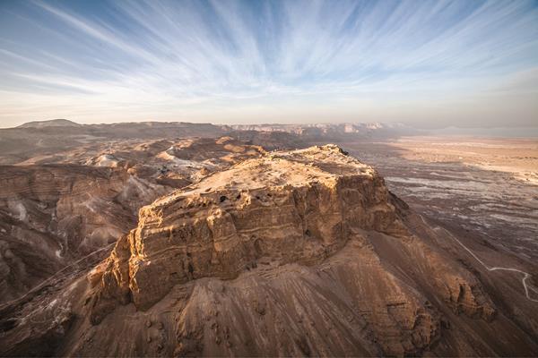
In the late morning hours of December 29, 1924, a British pilot took off from Amman, Jordan. Turning the nose of his Bristol fighter southwest toward the Dead Sea, he soon reached the mountain-plateau site of Masada, where King Herod had built an elaborate palace-fortress. At precisely 11:15 A.M., the pilot began conducting a series of aerial photography sorties. Taken at the altitude of 4,500 feet, the images were immortalized on glass negatives, which were deposited several years later in the library of the Institute of Archaeology of University College London.
Having been granted access several years ago to this unique aerial photography collection, my (Stiebel’s) attention was drawn to a subterranean feature located at the very center of Masada’s northern sector, adjacent to the Byzantine church. A clear oblong shape indicated the existence of a human-made structure—one that was no longer discernible at Masada. That is because, some 45 years ago, this unnoticed and therefore unexcavated structure was covered by the Israel Nature and Parks Authority (INPA). As a result, this 031virgin soil had been perfectly conserved.
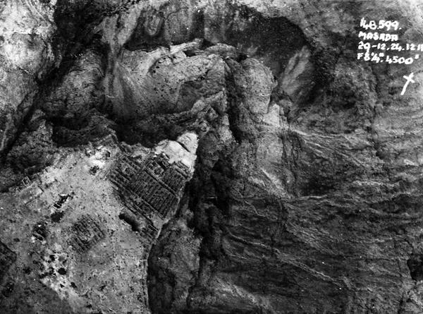
What was it? What was there that earlier excavations had missed? This question became one of the catalysts for initiating the new archaeological project at Masada by Tel Aviv University (TAU): the Neustadter Family Archaeological Expedition.1
The celebrated site of Masada, the first Israeli site to be nominated on UNESCO’s World Heritage list and the most visited national park in Israel, has been known to modern scholarship for more than 200 years. It was mentioned as early as 1806 by the German orientalist Ulrich Jasper Seetzen. At that time, the ruins were known by the local Bedouin as es-Sebbah—“the cursed one.”
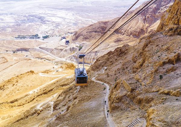
In 1838, Eli Smith, the assistant to the American scholar Edward Robinson, identified them as the arena for the dramatic events narrated by Flavius Josephus in his account the War of the Jews. Four years later, Samuel Walcott and William Tipping managed to ascend the mountain’s top, an achievement that generated a long list of renowned European and American scholars who were drawn to this remote and exotic site and who noted, among other things, the fortified palatial complex and its advanced water system, the snake path noted by Josephus, and the Roman siege system.
In 1955 and 1956, an Israeli joint expedition conducted two short seasons that demonstrated the great archaeological potential of the site, most notably from the time of King Herod the Great. However, it was the extensive three-year-long expedition headed by Yigael Yadin (1963–1965) on behalf of the Hebrew University and the Israel Exploration Society that marked Masada as a key site in the understanding of the early Roman period in Judea and beyond. With hundreds of volunteers from all over the world, the excavation provided an intimate insight into the palaces of King Herod and the poor dwellings of the Jewish rebels.
In 1989, Ehud Netzer conducted a short season at Masada, and he returned to the mountain for more extensive excavations with me (Stiebel) from 1995 to 2001 and for the 2007–2008 season. Gideon Foerster, Haim Goldfus, Benjamin Arubas, and Jodi Magness also conducted a short season in 1995 on Camp F and the Roman assault ramp.
Yadin once asserted that 97 percent of the site had been excavated. In light of this, the reader might wonder about our actual motivation to return to Masada. First, the vast amount of published archaeological data allows us to ask questions today that have not been addressed before, such as issues of identity, diversity, space, symbolism, economy, networks, site formation, and water management. Second, the arsenal of tools currently available to archaeologists has evolved dramatically in the past decades. Third, excavation methodology also has developed significantly since the early years of excavation at Masada; today it is possible to extract more data from much smaller excavation areas.
We were able to recruit to our expedition the expertise of colleagues who brought their labs’ equipment and teams to the field, enabling us to gain invaluable knowledge about various specialized subfields, including archaeobotany, archaeozoology, 034archaeometallurgy, and paleomagnetism. We set off to the field in 2017 and have conducted two seasons, with the aid of TAU’s students and volunteers from all over the world.
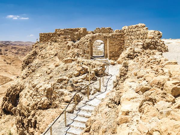
After arriving at the plateau’s top each morning to dig, there is an occasional sense of envy that creeps in while watching the swarm of tourists that visit Masada for the first time. The dominant color that meets their eyes upon entering the site is the palette of the desert—some 50 shades of yellow and brown. It is an awe-inspiring, breathtaking experience. Yet, to those of us who dig at the mountain each morning, these once-vibrant beiges and tans begin to look like the rest of the hot, dry desert occupying one’s field of vision for miles in all directions.
However, we can now demonstrate that this was clearly not the case during Herod’s reign. The study of early Roman horticulture and its associated material culture has become an informative tool regarding the Roman elite stratum, shedding light on questions of status and social, political, and cultural networks. The recent knowledge about Herod’s gardens, plants, and water installations at Jericho, Caesarea, and Herodium allows us to examine whether there were also developed agricultural enterprises at Masada. Josephus suggests this may be the case: “For the king reserved the top of the hill, whose soil was rich and softer than any valley, for agriculture, so that if ever there arrived some difficulty in procuring provisions from the outside, those who had entrusted their safety to the fortress would not be made destitute by this hardship” (War of the Jews 7.288).
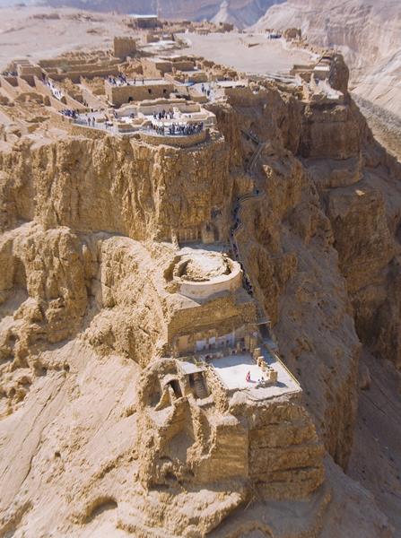
Learning from Josephus’s account that the soil of Masada was allegedly fertile, we wondered if we 035could identify evidence of such agricultural activity atop the mountain. Together with the team from TAU’s archaeobotanical laboratory led by Dafna Langutt, we excavated a series of probes in the semi-hemispheric feature of the Northern Palace’s upper terrace, which had been suggested to be a viridarium, a plantation of trees constituting what many call a “pleasure-garden.” 2 The semi-hemispheric balcony provided the royal residences of the Northern Palace with a spectacular view of the Dead Sea, the Moab mountains, and the oasis of En Gedi.
The soil excavated from this proposed pleasure garden underwent a thorough process of sifting, and an examination of the sediments yielded much botanical data. The identification of wood remains, micro-charcoals, and most notably pollen grains provides a fascinating glimpse into the king’s private garden. The ongoing study singled out the grape vine as one species that clearly blossomed in it.
Our examination of an aerial photograph from the 1950s led us to the location of possible plantations at the southern part of the mountain fortress. The photo showed scant remains, and our recent exploration indicated that the lines visible in the photo formed a system of shallow channels that allowed the irrigation of the plots. The cultivators used flood or furrow irrigation, a common practice to this very day among traditional farmers in the oasis of Jericho. Excess water was channeled into a small water cistern that ensured an optimal usage of this valuable element. Moreover, Langutt’s study of the sediment not only identified fertilizing agents, but also yielded the first signs of the presence of grape vines, most likely indicating the existence of a vineyard!
This manifestation of excessive usage of water and agriculture in the middle of the desert was further corroborated by the recent discovery of a winery at Herodium, another of King Herod’s palace-fortresses. The winery consisted of a group of pithoi used as fermentation tanks. It is noteworthy that some 50 identical pithoi were also documented at Masada, suggesting that the Roman elites’ practice of producing boutique wines spread into even the most remote and harshest environments of the Roman world, including the desert palatial fortresses of King Herod. One may note that, like the introduction of bathing culture, swimming pools, and public 036spectacles, the addition of Roman horticulture and viticulture practices further echoed Herod’s political and social ties to Augustan Rome.
In a world that suffers from climatic changes, the availability of water, particularly in the arid Judean Desert, has always been an essential and critical factor to enabling life. The historical reference that King Herod the Great had not only built a fortress that could house 10,000 soldiers, but also equipped its five palaces with water installations—including three bathhouses and a swimming pool—was first and foremost an indication that he had mastered the art of water collection and preservation. This know-how allowed him to construct a Roman villa maritima (“coastal villa”) in the middle of the desert, in the which he flaunted his water collection expertise through lavish horticulture projects.
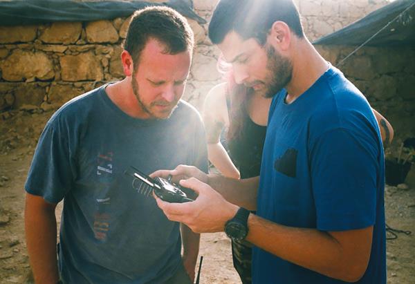
Masada’s advanced water system was studied extensively in the 20th century, and the availability of drone technology has allowed us to shed new light on this remarkable Herodian project. The 3D modeling of the site—particularly of its water aqueducts and irrigation system—has provided us with new data regarding these components and the way the surrounding flashflood waters were managed, captured, and thereafter brought up to the mountaintop.
The modeling of the trails leading up to Masada and of the Roman siege systema has yielded data regarding the volume of stones used in their construction. This new data will be instrumental in determining the trails’ chronology, as well as the length and nature of the Roman siege (in 73 C.E.).
We now return to our earlier question regarding 037the oblong subterranean feature we noticed on the 1924 photograph: What is it? Our excavations of this feature revealed two Herodian water cisterns, next to which the Byzantine church had been erected.3 The southern cistern had been restored and re-plastered during the Byzantine period by the small community of monastic hermits who inhabited what would come to be known as the Laura of Marda (“Monastery of Masada”). The monastery’s foundation story comes to us via Cyril of Scythopolis, who mentions the arrival of Euthymius (“the Great”; 377–473 C.E.) and one of his students at the site of Marda, which is identified with the fortress of Masada; here they found a dry well, which they restored, and next to which they built a chapel.
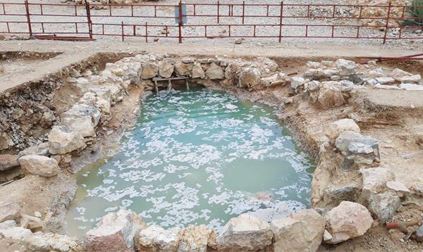
The immediate proximity of the southern water cistern to the church may corroborate this tradition. During the tropical storm that hit Israel in April 2018, the 16-foot-deep cistern was completely filled with water. The ancient plaster held the water for weeks, until finally it had to be pumped out to allow its conservation by the local INAP team.
Several centuries before the monastic hermits arrived, a group of Jewish rebels sought refuge at the desert fortresses of Masada during the Great Revolt against Rome (66–73 C.E.). Our quest in researching the Jewish rebels of Masada stems from the fundamental understanding that this community was not of a monolithic nature. It was far more complex than perceived in modernity and formed a microcosm of Judea during those turbulent times.4 The excavations of a large area of virgin soil near the Western Palace have yielded new remains that are securely dated to this time. In addition to a rich metal and coinage assemblage, organic material was uncovered, such as an intact wooden threshold and the wooden handle of a large key. Of great value are the animal bone remains, which reflect the rebels’ diet and indicate the animals of burden brought to the site. More significant is the identification of several living horizons (distinctive traits found across a large geographical area) from the time of the revolt that we hope will 038grant us a better dating and understanding of the different stages within the revolt from 66 to 73 C.E.
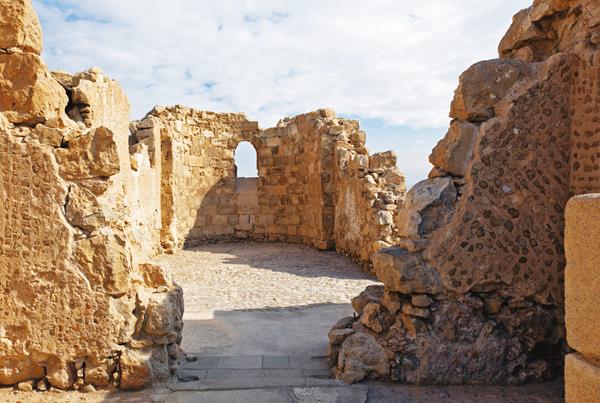
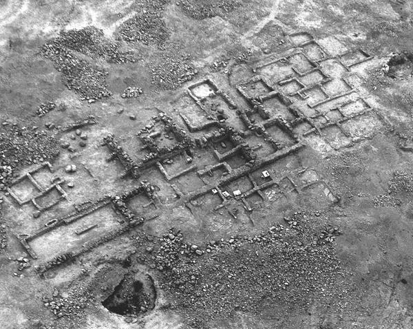
A few years ago, some suggested identifying a sector of Masada—including Building XIII (a large dwelling complex), the adjacent large communal ritual bath (mikveh), and several discovered sectarian manuscripts—with the presence of an Essene community (a Jewish sect, which notably has been affiliated with the sectarian settlement at Qumran and the Dead Sea Scrolls).b The outlines and dimensions of an elongated hall (in Building XIII) equipped with benches and a small side-room are strikingly similar to those of the refectorium (dining room) and pantry at Qumran.
These parallels led us to examine the unexcavated cave located some 10 feet west of that hall. 039The northern wing of the cave, which had been artificially shaped, had a well-designed entrance made of reused Herodian ashlar blocks and flanked by two triangular niches that had been shaped to accommodate oil lamps. During the excavation of the fill above the cave’s floor, a large fragment of a “scroll jar”—the type famously discovered at Qumran—was found. Alas, upon reaching the cave’s floor, it was found to contain a substantial amount of pottery from the Byzantine time, indicating that the cave had been used last by a Byzantine hermit—several centuries after the Great Revolt.
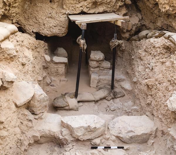
The cave awaits a team of volunteers to complete its excavation in the coming season.
That is not the only cave we are examining. Many of Masada’s caves functioned as stone quarries—with 040some reused as dwelling quarters and for storage. Our documentation of these caves has led our team to ask a little-explored research question: How was the site of Masada formed? Whereas the dolomite in the mountain was hewn as building material, the geological pockets of limestone supplied raw material for the lime industry. Several kilns were documented on top of the mountain and west of the site, the former of which awaits the results of optically stimulated luminescence (OSL) testing, mainly used to date geological sediments.
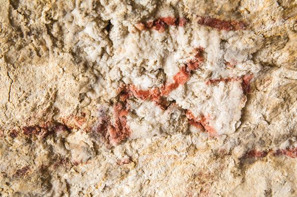
The majority of these limestone caves apparently had been transformed into solitude cells during the Byzantine period. In the late 19th century, a red painted inscription was noted in a cave adjacent to the church building. No mention was made then as to the language or the script used, and its mere existence was since forgotten. We revisited the cave last February, and, to our surprise we saw a clear red painted graffito, consisting of an inscription and a painting—one that escaped the eyes of all previous expeditions, including our own. It revealed to be a Palestinian Aramaic inscription, reading, “Lord Jesus”! An inscription with a similar formula was reported from a cave near the monastery of Kastellion (Khirbet el-Mird), which was founded on the ruins of the palatial fortress of Hyrcania, about 3 miles west of Qumran in the Judean Desert. The context and meaning of the full inscription and accompanying painting are under investigation. This unexcavated cave also will be dug in the 2019 season, alongside several other areas on the mountain-plateau and at its feet.
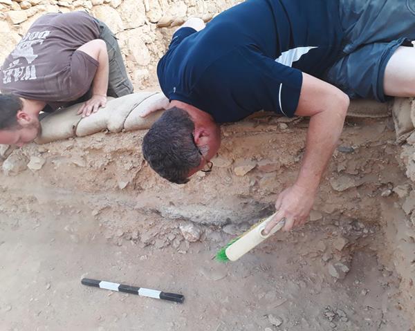
We await volunteers from around the world to come to the legendary mountain and become a part of history by participating in the excavation of Israel’s most famous national park—one that is still revealing its secrets today, and one that will never fail (to surprise) again!
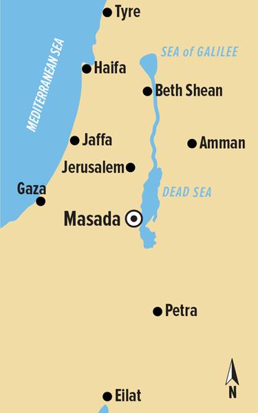
Masada—the remote mountain-plateau in the Judean Desert, where Herod built a palace-fortress and where Jewish Zealots made their last stand against the Romans—is being excavated once again. Get an inside look at some of the expedition’s preliminary findings, as excavations shed new light on the dramatic site.
You have already read your free article for this month. Please join the BAS Library or become an All Access member of BAS to gain full access to this article and so much more.
Already a library member? Log in here.
Institution user? Log in with your IP address or Username
Footnotes
1.
See Gwyn Davies, “The Masada Siege—From the Roman Viewpoint,” BAR, July/August 2014.
2.
See Sidnie White Crawford, “Scribe Links Qumran and Masada,” BAR, November/December 2012.
Endnotes
1.
The 2017/2018 staff comprised Guy Stiebel (Expedition Director); Boaz Gross (Field Director); Alexandra Wrathall (Area Supervisor and Administrator); Omer Ze’evi, Na’ama Walzer, Ayala Zilberstein, and Hai Ashkenazi (Area Supervisors); Joshua Errington (Surveyor); Yana Krilov-Levinger and Yuval Hai (Field Assistants); Shira Ben-Shahar and Chen Antler (Registrars and Field Assistants); Talya Ksenia (Assistant to Field Administrator); Sasha Flit (Photographer); and Orna Cohen (Conservation).
2. Classical archaeologist Gideon Foerster pointed out the architectural similarities between the layout of the upper terrace of the hanging Northern Palace at Masada and that of the Roman villa under Villa Farnesina, the suburban Renaissance home lying in the Via della Lungara in the Trastevere district in Rome, which has been suggested to be the residence of Marcus Agrippa, Herod’s benefactor.
3.
Our recent research regarding Herod the Great’s water usage resulted in our receiving the Third Shanghai Archaeological Forum (SAF) Discovery Award in 2017.
4.
This new understanding moves away from the “Sons of Light vs. Sons of Darkness” narrative that has typified the last 50 years of research following Yadin’s work and the subsequent criticism that followed in the past two decades. Both approaches appear to have missed multiple indicators of a far more heterogeneous group of rebels.
